
Social Studies · JCE / Physical environment and climate
StructuredPast exam questionForm 3 · JCE
Use the picture below (layers of rock squeezed from both sides, with an arrow pointing upwards).
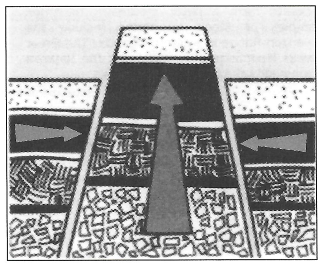
- aName the physical feature shown. [1]
- bDescribe how the feature shown is formed. [3]
- cExplain the influence of altitude on climate. [2]
You'll mark your own answer against the marking guide when you hand it in.
Source: BEC JCE Social Studies 2024, Paper 2, Question 3
Report a problem
More like this
- Study the map of East Africa below, showing the East African Rift zone.
- Study the map of Africa below. Region L is the Congo Basin.
- Study the map of Africa below. Area S is in the north-west of the continent.
- Answer the following about lakes.
- Use the diagram below illustrating one type of rainfall (warm ocean, prevailing winds rising over a hill, rain on the windward side and a rain shadow…
- The table below shows climatic conditions in country X.
- Study the map of Botswana below. X is the Okavango Delta.
- Study the map of Africa below. X marks the River Nile.