
Social Studies · JCE / Map work and location
StructuredPast exam questionForm 3 · JCE
Study the map of Botswana below.
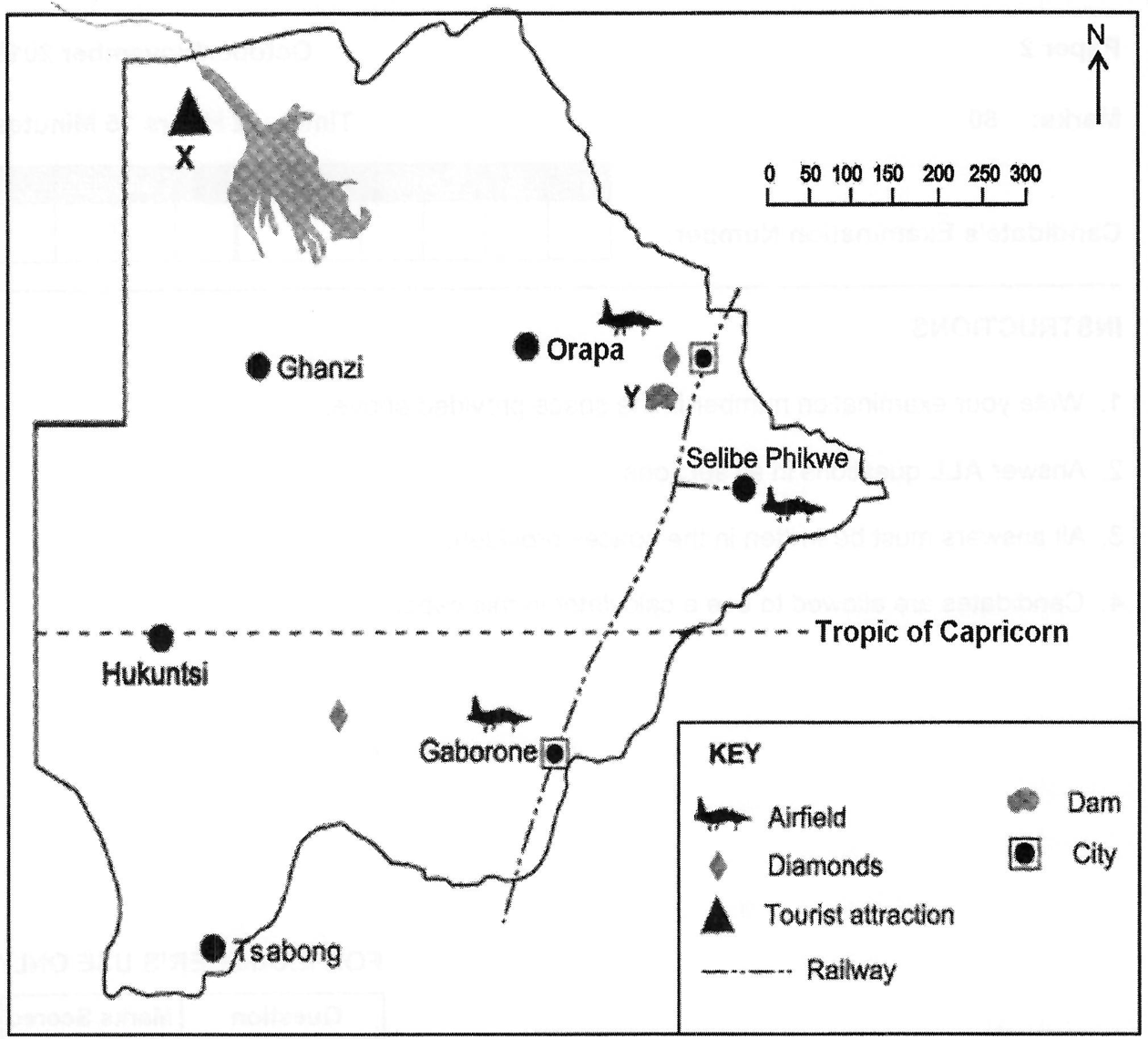
- aIdentify the tourist attraction marked X. [1]
- bIdentify the dam marked Y. [1]
- cIdentify the direction of Hukuntsi from Orapa. [1]
- dGive the straight line distance in kilometres between Tsabong and Ghanzi. [1]
- eState two factors that are evident in the map which could make people prefer to live in the eastern part of the country. [2]
You'll mark your own answer against the marking guide when you hand it in.
Source: BEC JCE Social Studies 2015, Paper 2, Question 1(a)
Report a problem
More like this
- Study the map of East Africa below (plate boundaries and the East African Rift zone).
- Study the map of Africa below (lines of latitude and longitude, scale 1 : 1000 and a linear scale in km).
- Study the map of Africa below.
- Use the map of Southern Africa shown below.
- Study the map of Botswana below.
- Study the map of Botswana below.
- Study the map of Africa below (scale 1:1000 and a linear scale).
- Study the world map below (scale 1:500 000).